Kano geospatial visualizer v2 is out !
Kano is a powerful geospatial visualizer supporting some advanced visualization capabilities in 2D and 3D thanks to hardware acceleration with WebGL technology. Driven by today’s most advanced web technologies, it also enables tracking your geospatial assets in real-time.

Introduction
During the past few months, it’s actually most of our ecosystem that has been revamped. We have migrated the latest versions of the main Open Source projects that are at the heart of our solutions: NodeJS (v16), FeathersJS (v5), Vue.js (v3) and Quasar (v2). This is a huge improvement towards a better security, reliability, efficiency and maintainability. Indeed, sustainability is the key challenge of Open Source projects.
Our solutions Weacast, Krawler, KDK, Kano, Akt’n’Map are running in production for years now and will then be ready for years to come. This would not have been possible without the support of Feathers Cloud Inc. and its founder David Luecke, who delivered the biggest external contribution to our ecosystem so far. And the cherry on the cake — Weacast is now a monorepo based on Lerna to ease its management.
In a previous article we gave an overview of our ecosystem, the subject of this article is to focus on the Kano web application.
Getting started with Kano
Here is a quick rundown of the key concepts to handle when you’re just getting started with Kano or geographic information system (GIS). In a nutshell, like any other GIS tool, Kano can be used to map, analyze, and assess real-world problems based on data, which is spatial or geographical in nature.
To achieve this, Kano is composed of two main activities (i.e. entry point for interacting with the user):
- a 2D activity to visualise and interact with data on a standard paperless map in 2D,
- a 3D activity to visualise data and interact with on a virtual globe in 3D.
The view of each activity can contain a basemap (i.e. a background context), a set of data layers (e.g. business specific data), an extent (i.e. the part of the Earth currently on the screen), and navigation tools to pan and zoom. A layer specifies how a geographic dataset is portrayed on the map or the globe. The final rendering supporting your use case can usually be assembled by adding a serie of layers.

A feature layer is a grouping of similar geographic elements, for example, buildings, cities, roads, earthquake epicenters, etc. Features can be points, lines, or polygons (i.e. vector data). Feature layers are most appropriate for visualizing your own data on top of your basemaps. Using Kano, you can view, save, edit and analyze your own features and their attributes. Moreover, you can include interactive pop-up windows with information about the features. Raster data, most commonly found in remotely sensed data, topographic data, satellite imagery, and aerial imagery, can also be visualized. For this, Kano can leverage OGC standards that use the internet to view, edit, manage and share geospatial data.
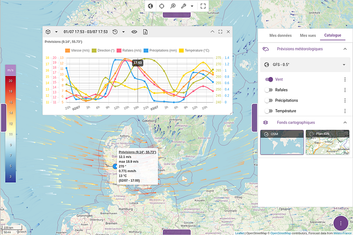
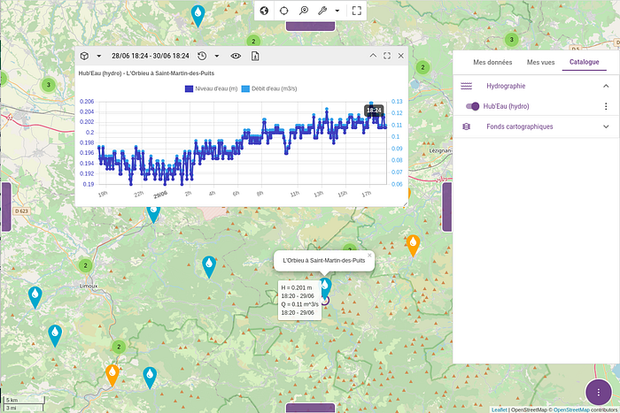
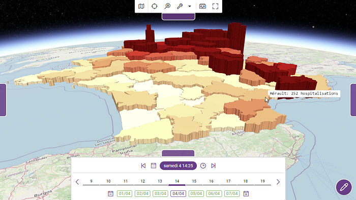
Kano manages both space and time information in order to visualize time-varying geospatial phenomena: tracking of moving objects, history of measures taken by a sensor, weather prediction over time, etc. When a layer displays a time-varying dataset you are able to navigate back and forward in time using a timeline to see the data at your requested date/time.
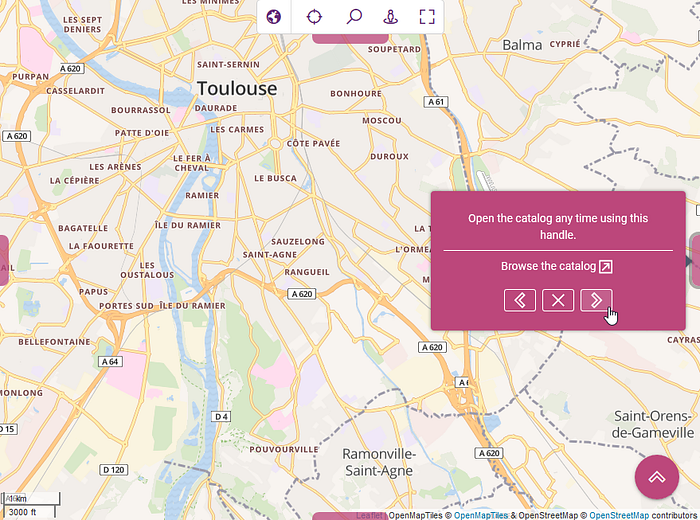
The starter guide of the documentation will give you an overview of the graphical user interface (GUI), Kano comes with small tutorials (a.k.a. tours) that can be directly run on the application in order to understand how its components can be used.
Running Kano
By following our installation guide and the provided sample configuration files you will be able to quickly run Kano with Docker.
docker-compose up -d

Kano integrates smoothly with Weacast in order to display weather forecast data.
docker-compose -f docker-compose.yml -f docker-compose-weacast.yml up -d
Kano integrates smoothly with Krawler jobs in order to feed data for near real-time measurements/observations layers.
docker-compose -f docker-compose.yml -f docker-compose-hubeau.yml up -d
A lot of built-in layers requires the associated job(s) to be deployed beside Kano. You can search for available jobs in our GitHub organisation and find more information about available layers in the Akt’n’Map catalog.
Go further
Kano is a web application for end-users, but it has also been designed to be integrated in third-party business applications and customized by developers (check out advanced usage documentation). Using a single and simple API, Kano provides developers with the capability to easily create 2D and 3D geospatial applications (check out the API reference). Last but not least, Kano comes with a built-in configuration for a set of geospatial data (check out the installation guide). However, you can complete it with your own spatial data.
Note: built-in layers are currently more developed in France but we are seeking for contributors to create similar layers in other countries !
We plan to write more articles in future to detail all customisation capabilities and we welcome any feedback from the community, so let’s conclude with a few points. The current development version of Kano is also available as a Progressive Web App (PWA) for a better integration with desktop and mobile devices. Kano is mostly based on the Kalisio Development Kit (KDK) that can be used to develop of geospatial web applications but also legacy applications because of its modularity and flexibility. Akt’n’Map is a typical example of such applications and you might find valuable tutorials on its mapping features, similar to what Kano provides as both rely on the KDK.
If you liked this article feel free to have a look at our Open Source solutions and enjoy some of our other articles, the Kalisio team !
